We are continuing operations with appropriate COVID-19 measures!!
Call (613) 799-5803
Email: info@deepviewlocates.com
Utility Locating
Services
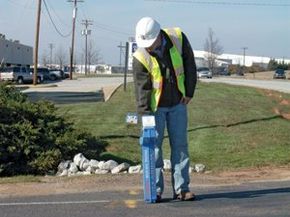
DeepView Locates Utility Location Services will ensure that you comply with the law, demonstrate diligence in managing the health and safety of your digging crew, and minimize your risk of damaging utility lines.
Not only can we locate privately owned facilities on your property or construction project, we can also coordinate all public utility locates.
We deliver a complete report clearly highlighting where all the underground services are both on and adjacent to your property.
Subsurface Utility Mapping (SUM) Services
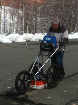
DeepView Locates uses the UtilityScan™ 400 MHZ ground penetrating radar (GPR) system, to identify, map and mark the location and depth of service utilities.
Concrete Scanning
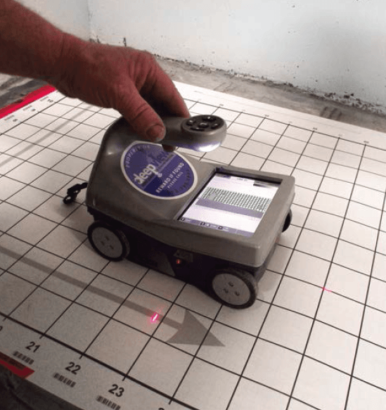
Avoid costly and dangerous damage, scan before you dig, drill or bore!
Ground Penetrating Radar (GPR) is the safest and most cost effective way to locate subsurface objects in concrete structures prior to cutting, boring or drilling.
Ground Penetrating Radar (GPR) is the safest and most cost effective way to locate subsurface objects in concrete structures prior to cutting, boring or drilling.
DeepView scanning equipment can locate:
- Structural Steel (Rebar)
- Conduits
- Concrete Evaluation
- Post Tensioned Cables
- Underground Heating Lines
- Voids
- Leaking Pipe Detection
GIS Mapping
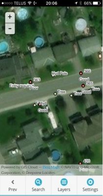
Mapping and tracking the location and condition of external assets combined with an ability to securely and easily access that information in the field is key to effectively and economically managing maintenance operations and lifecycle planning..
Our Services include:
• Setting up asset databases
• Developing data collection forms
• Field data collection
• Preparing asset reports
• Database maintenance*
• Software training
• Developing data collection forms
• Field data collection
• Preparing asset reports
• Database maintenance*
• Software training